Map of the Boston Marathon Finish Line Locations
Map of the four Boston Marathon Finish line locations
Last year I blogged about all the finish line locations for the Boston Marathon. It was a fun project to research the locations and the history of each site.
I looked at the blog content again and thought having a map would be a nice visual enhancement to the content.
Classic Boston Map
Back bay has changed a little over the past few years. So using a standard Google maps isn't going to help in this situation. Fortunately, there is a map in the Back Bay MBTA station that is about 20 years old. So I'll use that to show where the finish lines were located.
I took a picture of the map on the Commuter rail platform and then used Super Vectorizer 2 to convert it to an SVG image. I did this to allow the lines and shapes to be more define and make the map a bit clearer to read.
Finish Line Location Map
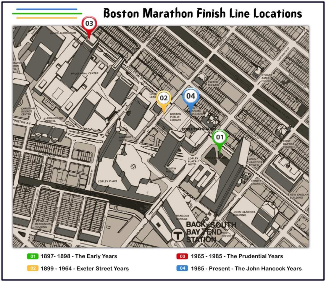
Click on image for a larger version of the map.
- 1897- 1898 - The Early Years
- 1899 - 1964 - Exeter Street Years
- 1965 - 1985 - The Prudential Years
- 1985 - Present - The John Hancock Years